Linear Trails: Connecting People to Places and Each Other
In Greater New Haven and north through the state's central corridor, off-road linear trails are getting lots of people moving again, while also bringing value to the economy, the environment and the community.
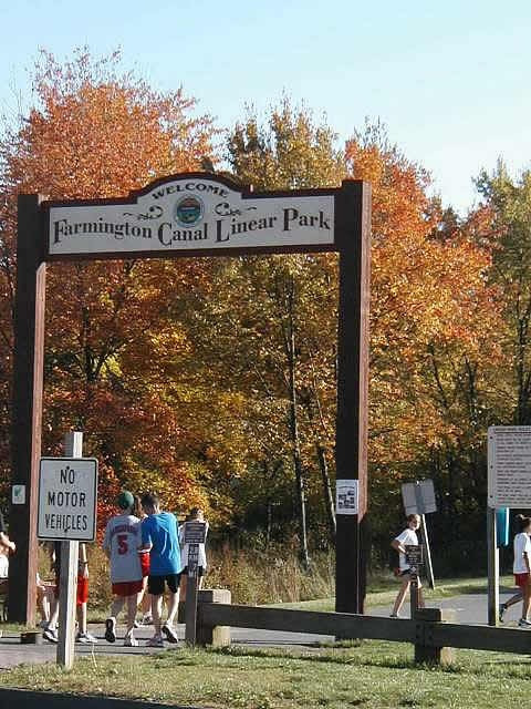 |
| Photo courtesy of Farmington Canal Rail to Trail Association |
Off-road linear trails not only get people moving, but also improve the economy, environment and community1.
Built on abandoned railroad beds and following rivers or other natural features, linear trails are usually paved and handicapped accessible. They make important connections within and between cities, suburbs and town centers, offering commuters a healthy and less-expensive alternative to car travel. They provide natural corridors for birds and wildlife. They connect residents and visitors alike to parks, historic sites and other special places. And they connect people with each other.
If You Build It They Will Come
One of the oldest examples in the country of an urban linear park is Boston's Emerald Necklace. Designed by Frederick Law Olmstead in the late 19th century, the Necklace winds through the city, connecting Boston's Public Garden to Franklin Park. Though never fully realized, the Necklace now consists of 1,200 acres of linked parks through Boston and Brookline.
New Haven is the southern starting point for the Farmington Canal Heritage Trail, which travels 84 miles to Northampton, MA. The trail follows the route of a canal built in the 1800s to connect New Haven Harbor with upland manufacturers. After the canal company went bankrupt, the route was converted to railroad tracks which remained in use until the early 1980s.
The land sat unused until being rediscovered by a citizens group that came together to protest the building of a mall on Dixwell Avenue in Hamden. The state owned the right-of-way and was about to sell it to a private developer when the group intervened and successfully petitioned to keep the land in the public domain. Soon after, a local group formed the Farmington Canal Rail to Trail Association, began working with cities and towns along its southern sections and applied for state and federal funds to build the trail.
Two-and a half decades later, the trail is 75-percent complete, much of it paid for with federal transportation funds. It includes an unbroken 14.5 mile stretch from downtown New Haven to Cheshire, and nearly the entire length from Farmington to the Massachusetts border. The Farmington section also connects to the Farmington River Trail, creating a 29.5 mile loop through five towns.
"Essentially what these studies are saying is that when you build these things, there is a big pent up demand for them," Donald said. "You've made this linear park that is kept in perpetuity as open space through the towns. Real estate along trail rises 10 to 20 percent, and the houses sell faster. You're building something that people really want."
Trails also bring much needed open space to dense urban areas. In New Haven, the Farmington Canal Heritage Trail runs through the Newhallville neighborhood, which has limited access to parks and recreational opportunities.
In addition to local residents, visitors are coming to trek the entire length of the trail from New Haven to Massachusetts, spending their tourist dollars along the way, according to Lisa Fernandez, President of the Farmington Canal Rail to Trail Association.
"It's been very exciting to see this regional interest," Fernandez said. It's a crown jewel."
Health and Recreation
By offering free and accessible places to walk, run and bike separate from unsafe automotive traffic, linear trails help address public health issues related to inactivity.
The U.S. Office of Disease Prevention and Health Promotion's national health agenda, Healthy People 2020, has set goals of at least 2 ½ hours of moderate physical activity 5 days or more2.
According to the Centers for Disease Control, however, only one in five adults meet the recommended minimum guidelines for physical activity3. While obesity rates are slightly lower in New Haven County than the U.S., they remain too high. In 2015, 63% of the adults in Greater New Haven were overweight or obese4.
In addition to helping control weight, the CDC recommends physical activity to help prevent heart disease, diabetes, and other chronic conditions.
In the lower Naugatuck Valley, the Derby Greenway Trail (DGT) was an instant hit with walkers and joggers from the moment it opened in 2006. Anchoring a route that is planned to continue along the Naugatuck River Greenway all the way to Torrington, the Derby section is so well-used that a special plow was purchased to keep it open during winter."It has exceeded everyone's expectations," said Jack Walsh, a DGT committee member. "From sun up to sun down, people are using it."
A Safe and Equitable Transportation Alternative
When used for commuting, trails take cars off the road, which has multiple benefits including reduced air pollution and traffic congestion5. Since the gaps have been filled in the Farmington Canal Heritage Trail between Cheshire and downtown New Haven, bike commuters are increasingly using the trail to access the many workplaces along or near its route such as Yale University, according to Fernandez.
A fully-realized trail network is also an important part of a multi-modal transportation system that benefits more than just bicycle enthusiasts. Elderly and disabled people need safe places to move and access bus stops, ride shares and town centers. In Farmington, Donald said that he frequently sees people in electric wheelchairs using the trails.
Accessible trails are also a matter of equity for people whose only options for transportation are walking, biking or the bus. In low-income New Haven neighborhoods like Newhallville, for example, less than half (42%) of the residents have ready access to a car6.
Linking People to Places and Each Other
By linking people to parks, historic sites, and other important places linear trails contribute to a sense of place. The Shoreline Greenway Trail, which starts at the historic Lighthouse Point in New Haven, will eventually be a 25-mile route to Hammonasset Beach State Park. When complete, the trail will connect parks, schools, town centers, train stations and hiking trails in East Haven, Branford, Guilford and Madison."People are very attracted to it, and it's a wonderful resource to get all generations together. You see kids and the elderly all using it," Fernandez said.
Linear Trails in Greater New Haven
The Derby Greenway
Opened in 2006, the trail along the banks of the Housatonic and Naugatuck Rivers runs between Division Street and Main Street, and is part of the Naugatuck River Greenway.
Farmington Canal Heritage Trail
The 84-mile trail starts in New Haven and will eventually connect to Northampton, Massachusetts. The Farmington Canal Rail to Trail Association coordinates work on the southern sections of the trail and the Farmington Valley Trails Council works on the northern sections.
Shelton Trails Network
Shelton has an extensive trails network, as well as a Riverwalk path along Canal Street. Access points vary.
The Linear Trail offers recreational access to all citizens - young and old, by foot, bike, skates, canoes, strollers and wheelchairs.Trail access: Lakeside Park: Hall Ave. and River Rd. in Wallingford.
Shoreline Greenway Trail
The Shoreline Greenway Trail offers bike riding paths, marsh views and bird watching. Trail access: Hammonasset Beach State Park.
What the Community Foundation is Doing
Several linear trail projects in the region have received support from The Community Foundation for Greater New Haven's unrestricted funds, as well as donor advised funds such as The Quinnipiac River Fund.- Shoreline Greenway Trail: The Community Foundation for Greater New Haven has granted $60,000 toward the creation of a 25-mile recreational trail.
- Quinnipiac River Linear Trail: The Quinnipiac River Fund has supported construction of a pedestrian bridge and information kiosks on Fireworks Island.
- Housatonic River Valley: The Community Foundation and its partner in philanthropy in the lower Naugatuck Valley (the Valley Community Foundation) have supported efforts by the Housatonic Valley Association for greenway construction and raising public awareness about conservation along the Housatonic and Naugatuck Rivers and Estuary.
- North Haven Trail Association: The Quinnipiac River Fund is supporting the clearing, cleaning up and maintenance of the Blue Trail along the Quinnipiac River's west bank in the Quinnipiac River State Park.
_______________________________________________________
Works Cited
1. Morris, Hugh. Trails and Greenways: Advancing the Smart Growth Agenda. Rails to Trails Conservancy, Sept. 2002.2.Healthy People 2020, U.S. Dept. of Health and Human Services
3. Morbidity and Mortality Weekly Report (MMWR): Weekly May 3, 2013 / 62(17); 326-330.
4. Abraham, M, et al. (2015). DataHaven Community Wellbeing Survey, Greater New Haven Crosstabs. DataHaven. 9.
5. Morris, Hugh. Trails and Greenways: Advancing the Smart Growth Agenda. Rails to Trails Conservancy, Sept. 2002.
6. Levy, Don. Greater New Haven Community Wellbeing Survey 2012: Report on Preliminary Results, p. 24. Siena Research Institute.
The Community Foundation for Greater New Haven
© April 2015